Thursday, June 3, 2010

Macomb, South Dix, East Dix (5/12/10)


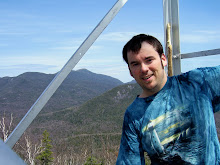
So, my first "summer" high peak of the year started off totally by accident. I was planning on hiking Noonmark and Round Mt as a loop with the hiking group, but when no one signed up and I chanced on seeing someone post a comment about hiking Macomb on the same day, I jumped at the chance to upgrade my hike! I met up with Tracy and Bruce and we headed out of the Elk Lake trailhead, my first time to Elk Lake! The trail back to the starting point of the Macomb trailhead was pretty simple, basically just a walk in the woods. When we reached the turnoff point, just past Slide Brook we started the real hiking. The entire Dix range, with the exception of it's signature mountain, is trailess and quite remote and wild. I was excited and a little nervous about this hike, as it was my first time doing a slide hike. We got to the base of the Macomb slide around an hour after we took the turnoff onto the herd path. The Macomb slide is a bit unique from what I know in that it's made up primarily of loose rock, or scree. Being my first slide to climb I can't say how it compares to others, but I thought it was relatively easy to climb. It was steep in spots and the loose rocks made it tricky but my distain for heights never came into play. It was nice once we got to the top to take a breather and snap some photos on the famous boulder that overlooks the slide. We had an awesome day to go hiking! The weather was fairly sunny and maybe in the 70's. Once we left the top of the slide we had probably the steepest climb of the day, but over a kinda short stretch, to the summit of Macomb. The views from the top, while limited in range, did not disappoint in quality! Great views of Elk lake, and many of the high peaks. I even had the company of a little mountain sparrow while I ate lunch on the top. After a bite to eat, it was only I think 11:30am and we all still felt fairly full of energy and so after some discussion we decided to make the push to get the rest of the "lower" Dixes in. Since we were up on the ridgeline the effort would be moderate to minimal to get South and East Dix in. On the backside, or eastside of Macomb we encountered a little bit of ice and snow remnants, but very little and it posed no difficulty to our passage. Down into the col between Macomb and South Dix, then up the rocky scramble to South Dix. That part was pretty fun. We had some nice views from the open rocks and since there are zero views from the actual summit of South Dix we took some pictures and soaked it in. The ridge-line walk between all three mountains was interesting. I was a bit concerned from having read up on the Dix range and seeing everyone talk about how remote and the jumble of herd paths and that you should be ready with your compass and maps for the challenge of navigating them, but whether over the past few years the paths have become more established or I just have an eye for keeping a trail, we never had an issue finding and following the herd paths for the entire day. There were certainly some stretches of trail where it was so tight that you had to force your way through the cripplebrush and evergreens but the footpath itself was distinguishable. As we reached the third high peak summit of the day on East Dix, I was really impressed with the panoramic view it offered! All the way from Giant and Rocky Ridge, to the foothills in the South, South Dix and Macomb to the West, and Hough and Dix to the North, the views were awesome! Really a beautiful sight. I wish I had known exactly where the Great Slide was, as it would have been cool to gone and looked down on it, but I hadn't expected to be on East Dix that day and didn't read up on it. Well, our trip back was pleasantly uneventful. We made it back to the top of Macomb without a hitch. The toughest part of the hike might have been the descent down the slide. Having to pick your way down the steepness with loose rocks breaking way and sliding from under your feet definitely was a tedious and tiring process. We all made it down though safe and sound and although I think all of us were a bit sore and tired after 11 hours on the trail, we made it back to the cars happy and with a great sense of accomplishment! A wonderful hike through a great wilderness!

Wednesday, April 7, 2010

Phelps Mtn 2/18/10

I went into this winter wanted to get a couple high peaks done, to take some of the load off this coming summer. As it turned out, I ended up only getting this one. We left early in the morning and were on the trail by 9am. It was myself and HikingMates partner Jennifer. We started out of the Adirondack Loj, up past Marcy Dam and back the same way. The temps were pretty mild, in the twenties, but unfortunately the cloud cover was very low so our visibility was very poor for the hike, with no visibility at the top. The trails up to the Phelps trail were packed snow, with 2-3 inches of fresh powder on top. When we got to the Phelps trail we threw on our traction for the steeps and ice that we found on the last stretch. Overall, no issues with traction or on the trail. We encountered several parties on the way in, including a group that had over-nighted and was headed up to Algonquin, and then a handful of parties snowshoeing and skiing on the way back down. The black capped chickadees were out in force around Marcy Dam. We stopped for a picture and they came right down and were landing on my trekking poles, and even my hand! I'm sure they were hoping we had a snack for them, but no luck. Overall, I had a great time, but another hike this winter with no views or limited views on top. Oh well.

Big Slide 10/18/09

I decided to do the hike via the Brothers, and down Slide Brook to create a fun loop. My friend Dan and I had tried to do this hike last year, well not the loop but over the Brothers, and ran out of time to finish it. This time we left earlier in the morning and gave ourselves plenty of time to finish. When we left the Garden we were hiking in fall conditions: cool, leaves on the ground and some blue skies. As we made our way up past the second Brother we encountered snow and ice. We took a snack break on top of the first Brother and its great views entertained. There were still fall colors throughout the Great Range, but barely. One more week and they were probably gone. The hike from the second Brother up the the summit of Big Slide was over snow and ice, well mostly ice. The micro spikes we brought work like a charm. The last jaunt up to the summit was quite steep, with a couple ladders thrown in, but nothing technical, just had to do some scrambling. Once we made it to the top, I was amazed by the range of the views to be had. I think I counted 22 visible high peaks from the summit! I think this is currently my favorite vista from a high peak to date! The trail down the Slide Brook trail was much easier than the trail up over the Brothers and even easier from the Interior post back to the Garden. We passed a couple of leentos and jumped a two deer as we made our way back out. Overall a awesome hike, one that I won't mind doing again.

Thursday, October 22, 2009

Algonquin, Wright Mountains: Winter Wonderland (10/14/09)


This was another hike that I organized through a local hiking group, so there ended up being seven of us that went on this hike. As I kept track of the weather, as hike date approached I knew there would be a very good chance of having some snow and ice on the tops of the mountain, so when we actually saw some it wasn't really a surprise. What was a surprise was how low an elevation that the snow stuck and how much was on the tops. The trees were frosty white that morning I would say as low as 3000' and the last two thirds of the trail was in snow and ice. We were thankfully prepared and brought our traction control, for me a chance to really test my micro-spikes out. After the trip as a whole, climbing up and down solid sheets of ice, hopping from snow covered rock to rock, and wading through drifts several times up to my knees I give the micro-spikes a solid two thumbs up! Our goal going into the hike was to do Algonquin, Wright and Iroquois. Unfortunately, due to the pace of the group as a whole, the weather conditions and temps and energy levels we stopped after only doing Wright and Algonquin. I'll just have to go back and do Algonquin and Iroquois another day, which isn't all that bad since we were in the clouds on top of both mountain and had zero visibility. The overall trail wasn't extremely long, but the last pushes up both Wright and Algonquin had their share of very steep pitches, both rock slab scrambles and rock hopping. It was definitely a neat experience doing it when everything was covered in snow and ice. It gives everything a different look. Having some sort of traction was a must. It was interesting to see the change in temperature the higher you went, in the trail became more solid and no running water. We had a quick lunch on the shoulder of Wright Mt before heading back down and up Algonquin. Even being mid week and very wintery, we did encounter at least 4 or 5 parties who were also doing the hike that day. Once we got to the summit of Algonquin, we snagged a few quick photos and decided not to pursue Iroquois today. The trip back always seems to be longer than the way up, I'm sure due to several factors. Anyway, we all made it back to the Loj without any complications and I bagged #16 & 17 for this year.

Saturday, October 10, 2009

Giant & Rocky Ridge Peak 9/30/09

There was a low percent chance of rain for the day and when we started the hike the temps were in the high 30's, so we really weren't sure what to expect on this hike. I had been wanting to do this hike for a while now, but had determined to hold off and do it in the peak of leaf season as it has been described as possibly the best fall foliage hike in the high peaks. I ended up doing the hike with four others from a hiking group I am apart of. I decided to do the hike out of the Rt 9 trail head, up over Blueberry Cobbles, Bald Peak, Rocky Ridge Peak, and lastly Giant. The trail to the top of Giant is eight miles and a huge 5300' ascension! Since we had enough people to spot cars we decided to do that to cut down on the mileage. By the time we actually got hiking it was 9am. The weather was mostly cloudy but no precipitation and the colors were still in pretty close to peak season. The hike up from the Rt9 trail head has many vistas and exposed rocky ridge lines that offer many great views. We kept a steady pace for most of the way up, with lots of photo breaks, so by the time we completed the hike and got down to the car at the base of the Ridge trail it was close to 6:15pm. As it was close to noon when we reached the summit of Bald Peak, we decided to stop and have lunch there. Oh, one thing that seems to stand out about this hike from a wildlife standpoint was the number of grouse we jumped. I believe over the course of our ascent we jumped at least 6 grouse! And, just before the summit of Bald Peak we came across a very chatty bird who I mimicked in conversation for several minutes. He must have been very welcoming of the conversation, lol. The trail was really quite dry over almost the entire stretch of the trek with the small exception being around Lake Mary-Louis and the small water crossing there. As we approached the summit of Rocky Ridge we crossed over some really cool alpine meadows which added a nice variety to the course of the hike. As we got close to the summit of Rocky Ridge we climbed into a snow squall, the first snow of the year! As it turned out, we were in snow on the summit of both high peaks today; the trees and grass held the snow, but the ground itself was still to warm to hold it. We stopped briefly on top of Rocky Peak for photos, but the wind was very strong and with the temps made it too cold to stay there for any longer. The descent into the col between RRP and Giant was quite easy; it was the ascent up the east side of Giant that was by far the steepest and roughest on the hike today. Even still it went by with no problems and we made it to the top of Giant with no issues. Unfortunately we were in a snow cloud so we had close to zero visibility on the top of Giant. Oh well. The last three miles down Giant were definitely the most unpleasant for me. All three are steep and rough with no breaks in the loss of elevation. As it is, I would rather climb steep than descent it. My knees don't care for it too much, heh. Anyway over all we all had a great time, on one of the toughest hikes yet. Two more bite the dust! #14,15 of this year.

Friday, September 18, 2009

Mt Marshall (9/16/09)

#13 this year, #16 total.
It was a nice fall day for a hike. I headed out with my friend Rob for the Upper Works trail head at 8:30am and we were on the trail by 10:45am. The weather was nice for hiking, not as warm or sunny as other days, but maybe 55-60F for most of the hike and a mostly cloudy (but no rain) day. When I was planning the trip I didn't really count the miles carefully and was under the assumption that it would be close to 10 miles round trip. In actuality it was around 14 miles and ended up taking us a little longer than originally thought. The trail back to the Flowed Lands/Calamity Pond was very nice. There was some elevation gain but nothing more than moderate and the trail was very well established and maintained, with some really beautiful scenery along the way. Several spots we saw the beginning of the turning of the fall colors. We took a short stop to check out the David Henderson monument, at the site where he accidentally shot and killed himself back in 1845. As we approached the Flowed Lands lean-to, I got my first foot soaker of the year when I was rock hopping over some muddy water and my right foot slipped and sunk over the top of my boot. My foot got a bit wet, but not squishy wet so I didn't change out my socks on the spot. When we got the the Flowed Lands area we took a few minutes to enjoy the awesome view! It truly is a gorgeous area. From there up to the break off point up to Marshall the trail went quick. The trail up Mt Marshall is deemed trailess, but the herd path up is well defined and marked where needed so we had no problems finding our way. For the first two thirds of the trail, the path follows a stream bed up. I have heard that Marshall is known for its moss and I definitely can see why after climbing it. I have never seen so much lush, dense moss as there is along the trail up. It is like a carpet of soft, fuzzy green everywhere! We had a couple steep pitches up the second half of the Marshall trail, and the last quarter of a mile had a few rock scrambles that were needed to navigate up. Once we made it too the top, it was PB&J time and I finally got out of the wet socks! Off a short side trail we had some really nice views of Marcy, Skylight, Redfield, Allen, Cliff and the Santinoni Range. On the way back down, we enjoyed several great views of Iroquois Mt. We picked our pace up a bit on the way back down in an effort to make it out before darkness set in, and we only ended up doing the last .25 mile or so in the dark. Overall the trip took us close to 8.5 hours. It was a great time, with some super views. Another one bites the dust!

Monday, September 14, 2009

Sawteeth, tail of two trails (9/2/09)


A beautiful day for a hike! Sunny, low humidity, and temps in the 60's... I had hiked Sawteeth a number of years ago with my dad, doing an up and back on the Scenic trail, but as it turned out didn't quite make it to the top of the actual summit, just the shorter of the two. I decided this time to make a loop of it, going up the Gothics trail, and down the Scenic trail. First time in a while I had to do the entire length of the Lake road, but at least it goes by fast. The trek up on the Gothics trail was pretty straight forward. Shortly into the hike, a great view of Rainbow Falls is available. It is really a sweet view. The rest of the way up to the col and the split in the trail between Sawteeth and Pyramid wasn't too bad; a steep stretch here and there but nothing to demanding. After taking the turn up to the summit of Sawteeth one needs to climb through a crevasse in the rock, but its surface is rough enough that footing isn't too difficult as long as you pay attention. The view from the top of Sawteeth towards the Great Range is fantastic! You get a great up close and personal view of Pyramid, Saddleback and Basin, along with views of Armstrong, Haystack and Marcy. After munching down my PB&J sandwich I continued down the col between the two summits of Sawteeth. It was by far the muddiest part of the trip, which one would expect of cols. Maybe because it had been so long ago that I had climbed Sawteeth via the Scenic trail I had forgotten how absolutely rough and rugged it is! Out of all the trails I have hiked so far, I definitely feel confidant saying it is the most rugged trail I've hiked! Ever step for pretty much the entire length of the trail requires careful thought and effort, whether do to steepness, ruggedness or even the flat spots were across the face of the mountain that requires uneven footing. Even when I had completed all of the decent and arrived at the lake, the trail was nothing but boulder and tree navigation. I know that many times the hike up a mountain takes longer than the decent, but in this case due to the different difficulty of trails, it was exactly the opposite. The Scenic trail does offer some amazing views towards Dix, Nippletop, Dial, Colvin and Blake mountains along with the Lower Ausable lake, Fishhawk cliffs and Indian Head so all the work isn't for nothing. I was happy because even though the decent took allot out of me, especially my feet, I had enough energy to jog my way back down the Lake road to the check out. Another high peak of the list! #12