Wednesday, December 29, 2010

Trifecta: Marcy, Skylight & Gray (8/25/10)


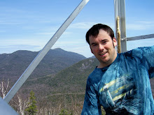
Getting close, only three hikes left! Patrick, Tracy and I started out of the Loj and headed for Lake Arnold to do this as a loop hike. As we started the day, the weather was pretty decent, but as the day continued it got worse and worse as rain clouds moved in. We still had some nice weather as we passed between Colden and Gray through the Feldspar. By the time we started the climb to Tear of the Clouds and the Four Corners the rain had started and it really never let up for the rest of the day. When we got the the lake, Tracy went on to wait for us, since she had already hiked Gray and had no desire to go slopping up to the summit in the rain, so Patrick and I who both needed it, trudged up through the wet trees and eventually made it to the top in the middle of the clouds. We snapped a couple photos and descended back down and headed up to the Four Corners to meet up with Tracy. When we got there we found her and the other two members of the hike that started late and had planned to catch up with us there. We took a lunch break and dropped our packs for a quick jaunt up to the summit of Skylight. I love hiking in the alpine terrain , and with the rain and clouds that's about all the view I got to enjoy. Since it was already crappy weather I didn't bother to bring a rock up to the top of Skylight, as the tradition is. We picked up our packs and make the last, and steepest climb of the day, up the backside of Mt Marcy. That approach definitely takes the cake for the longest, exposed rock scramble to a summit that I have yet to do. It was made a bit more treacherous because of the rain on the rocks make them even less grippy. The calves were burning a bit, but everyone made it to the top, safe and sound. We didn't linger too much though due to the rain, wind, and lack of views, so we started trucking on down the mountain. This was the first time I had ever been up Marcy without it being snow and ice covered. Marcy was actually the first high peak that I every summited back in the mid 90's. We all made really good time on our descent, considering that we had to mind the wet rocks. Once we reached the Phelps trail splitoff, several of us decided to jog the rest of the way out. Just after crossing Marcy Dam the rain turned into pouring rain and only increased the desire to get back to the Loj as fast as possible to change out of the wet clothes. It was unfortunate that this hike was socked in like it was and offered no views, but I have no doubts that I'll head back up another time and will get to enjoy the views then. Three more and counting!

Basin and the Infamous Saddleback (8/11/10)


Ahh Saddleback, or specifically the west side cliff traverse. Easily the single most challenging and fear inspiring section of the entire ADK 46 trek. I have become quite good and confident with rock scrambles, so I knew I could do it, but heights aren't my strong point, and depending on who you listen to the stretch could be fairly straightforward as long as you are cautious or down right death defying. Well, I would be able to make that distinction after today.

Myself and two girls from Hiking Mates headed out from the Garden early on this Wednesday morning to tackle these two daunting high peaks. On our way there we took a short break to take a peak at the John's Brook Lodge. I had never seen it before so it was nice to check it out. Looking back on the hike, I think my least enjoyable part is that it takes such a long approach just to get to the mountains. Well, I guess that is all part of the challenge. We passed a large number of people on the trails today, probably more than any other hike that I've been on. It was a gorgeous day, so I can't blame people for being out to enjoy it. I found the forest as we approached Slant Rock to be really cool looking. Once we reached Slant Rock, we took a quick snack break to carb up, and then took the Shorey Short cut up and over to the State Range trail that would take us to the top of Basin. As a whole, I think the climb up Basin had the most, and many difficult rock scrambles of any mountain I have hiked. I would consider it among the most difficult to climb, when combining that along with the distance it takes to get there. That doesn't mean I didn't enjoy it; I actually found it to be one of my favorite mountains, climb and the amazing view off the summit! We had lunch on the top, soaked up the view and the sun before we turned our attention to the next mountain on our agenda, Saddleback. As we approached the mountain, you get a really good look at the cliff you need to scale to get to the top and it was quite intimidating! I've learned though, that if you look at certain routes as a whole big picture, it can be much worse, than if you break it down into 10-20 feet stretches. As we got to the base of the cliff, that's exactly what I did. You can look at it as little scrambles, stop plan the next, and attack it, and next thing you know, your done! It definitely is steep, but it's not scaling a shear cliff; there are definitely ways to break it up to make it very doable. That said, you certainly wouldn't want to slip and fall because it still is a 100' or so rock traverse. Once I made it to the top I was absolutely exhilarating! I had conquered the most intimidating section of the entire trek! And, I had a blast doing it! :) We took some time to savor what we had accomplished and then worked on finishing the hike. The hike back to the car was again long and tiring, but went by very smoothly. Overall I'd give this hike two thumbs up!

Great Range Rovin'! Gothics, Armstrong, Upper Wolf Jaw (7/28/10)


I had been looking forward to this hike for a long time. I had been saving Gothics and the big three (Marcy, Haystack and Skylight) for the end of my trek. I wanted to finish on a high, literally and figuratively. I also had been looking forward to climbing Pyramid for obviously reasons even though it isn't a technical high peak. This was another hike that I did solo, and I began my trip from the Ausable Club and up the Gothics trail toward Pyramid. The weather was nice and warm, but not too hot with a chance of an afternoon shower. Actually I was going to do this hike in the reverse order to save the best views for last, but because of the chance of rain and the suggestion of the man in the check in shack, I went for the good stuff while the going was good. The sailing was easy up till the trail splits off for the push up Pyramid, then it got steep fast. Lots of rock scrambling to be had here and throughout this hike. By the time I reached the summit of both Pyramid and Gothics the weather was still great, blue skies, with puffy clouds. And, the views lived up to all the hype, absolutely breath-taking! It is easy to see why people call Gothics/Pyramid tops on many lists. I took a good amount of time on top to savor it while I could. Finally it was time to move on and I began my descent towards Armstrong. I'm glad to have my trekking poles and new Scarpa boots because the hike over the Range is as rugged and rocky as they come. There was much grasping, grappling and scooching down and over the rocks boulders and faces. Just as I was approaching Armstrong a short little rain burst started up. Thankfully the rain didn't last, as it would have make the rest of the hike less enjoyable and difficult. On the ridgeline I did have the company of another hiker, also named Dave, who was up from I believe Pennsylvania with a hiking buddy for the week. We parted ways on the top of Upper Wolf Jaws, as I made my way back down Wedge Brook trail and began the long walk back to the car. I was blessed with a great hike over some of the most spectacular mountain in the state today. Three more down, eight left!

The Sewards and Seymour, ugh. (7/13-14/10)


My second backpacking trip and back to back! They way I planned out my finishing of the quest for the 46 was to get as many of the less desirable hike, ie trailess mud-fests, out of the way so that I would be able to finish on some of the "fun" ones, with great views. In order to do that, I needed to knock out the Seward Range and by doing so that would leave me with only one trailess peak left out of my last dozen or so. Because of the distance traveled to get to them and the nature of the trails for them, it was an easy decision to make this a backpack overnight to get all four done. Myself Jim and Patrick went in at Coreys and ended up setting up camp at the Ward Brook leen-to. Our plan was to hike in, set up camp and hike Seymour on Tuesday, hike the three in the Seward Range on Wednesday and depending on time and energy hike out on Thursday. Once we dropped our backpacks and tackled Seymour we made good time. It's not that long of a trail, it just happens to be very steep and muddy and rugged. Also, these couple of days were unfortunately very hot and humid. In fact with temperatures cresting in the 90F range and combined with the high humidity and very rugged terrain, this was the most grueling hike I have ever done. Well, not Seymour specifically, that was just super sweaty and tough for a few hours. We happened to cross paths with a group of 6-8 middle school-high school kids who were away at camp and were going to back the same mountains as us. Impressive and great to see kids getting out and tackling the mountains! We enjoyed a really nice fire at camp that evening as we relaxed and rested up for the long day that was coming.

We ate our breakfast the next morning and hit the trail sometime around 8am, and began our climb up what I am calling the most rugged and consistently steep trail I have every climbed and combined with the oppressive heat, least favorite trail...Ward Brook trail up Seward. I don't think I've ever disliked one stretch of trail as much as I did that one, on that day. Given cooler temps, maybe my opinion would differ, but for know it stands. Well sure enough, we made it to the top of Seward, Jim and I a bit after Patrick who is a mountain goat, lol. Not too much for the way of views from Seward, so down the steep rocky chutes and over to Donaldson for the best views of the day and lunch. Our trek over to Emmons went fairly uneventful, with the exception of me jabbing my head pretty hard on a branch as I was navigating part of the bog. Oh well, it happens. By the time we reached Emmons we were whupped and wishing we could take a helicopter ride back to camp, but unfortunately that was not the case. Back we went, up and over and down, retracing our steps. Unforntunely the way back didn't shrink at all even though I kept thinking, the trailhead HAS to be just around this bend. Eventually we did make it back to camp, and as I calculated had moved at the slowest rate of speed of any hike I have done, close to 10 hours for just over 8 miles! Yah, it was a beast. Well, another night in the woods, and we broke camp in the morning and were so glad that we didn't try to hike out the night before. By the time we reached the car we were craving some non-camp food and ice-cream! It's amazing what a few days in the woods can do. Hurrah, the last of the trailess marathons are done!

Cliff and Redfield Backpacking Adventure! (6/30/10)


I was looking forward to this hike, not so much for the mountains themselves, but for the fact that this was my first actually backpacking trip! I've done many a day trip, but this was my entrance into the overnight scene. Three of use made the venture in from the Upper Works trailhead on Tuesday morning, back to the Flowed Lands, and around to our campsite at Colden Dam. Our campsite was superb: flat groomed tent-sites, easy access stream water and great views from the dam itself. A special thanks to Jim for bringing some dessert that night! Well in the morning we woke up, cooked breakfast and were on the trail by close to 8am. The two days before we arrived in the Adirondacks, there had been some heavy rains and the trails back to camp were extra muddy to show for it. This was also apparent on our hike back along the Opalescent River which was roaring and the most spectacular display of flumes, falls and cascades I think I've ever seen! Truly worth the hike just for that. We followed the trail up the the Uphill Leen-to, followed the herd path to the split and slogged through the water and mud up the the cliffs of Cliff Mt. I think the ascent up Cliff takes the award for the most mini rock cliff scrambles of any mountain I've hiked. They just take time and caution to navigate them properly, but I really enjoy the rock scrambles so it didn't bother me. Having been properly warned, we made it to the top of the false summit, and continued on, for what seemed like a long time, before reaching the sign and the actual summit of Cliff. We snapped a few quick photos but didn't linger knowing that we still had to retrace our steps, head over and climb Redfield, go back and break camp, and hike out still. Much of the herd path up Redfield either followed the brook or was directly in the brook and led to numerous beautiful vistas along the way. The trail up to the summit was easy to follow and by comparison to the high peaks on a whole, not that rough. We took little bit to have lunch and enjoy the views off the top, most to the South, then began the decent back to camp. My feet were a bit sore from all the hiking and backpacking to that point so I reserved a few minutes to soak my feet in the cold water of Lake Colden before breaking down camp. We were fortunate that we were able to get all packed up and start heading out when we did, because withing 2 minutes of leaving camp, a heavy rain started coming down and continued on and off for most of the death march back to the car. I for some reason seem to dislike the walk out of the Flowed Lands more than any other. It just seems to get longer and longer each time I hike it. But, overall my first backpacking trip was a great success. Two more high peaks down, no bear visits, and safe and sound!

Mt Colden, the rise of the Captain! (6/23/10)


Our hiking party today consisted of five members of Hiking Mates. We started out of the Loj, and made our way up through Avalanche Pass and Lake, over to Lake Colden, up the back side of Colden and then down to Lake Arnold and back to the Loj. This was my first time to Avalanche Lake when it wasn't frozen and so therefore my first time having to use the hitch-up-matildas. That was a pretty cool experience and very scenic, although the path along the lake was as rugged as any stretch of "flat" trail there is; kinda reminds me of the bottom of the Scenic trail to Sawteeth Mt. We started out the hike with an overcast sky and a few misty drops, but were suppose to have clearing skies as the day went along. We took a quick little fuel-up break at the trail junction at Lake Colden to give us some energy to finish the assault of Mount Colden and it's a good thing! The trail from that direction is one of the more consistently steep trails in the 'dacks, and most of it was over rock slabs that had water running down them. Thankfully they weren't slick like that of Allen, and the footing was surprisingly good. Slowly but surely we all made our way up to the ladder, and attacked the last open rock scrambles to make it to the top. There was one tricky scramble were a couple of the hikers didn't think they could make it, and one trekking pole didn't, but with a little bit of courage all conquered the mountain and made it to the top! Once on top, and the cameras came out, I unknowingly started a summit photo ritual by deciding to pose on the top in the "Captain Morgan" pose. lol Also, just as we reached the summit the clouds finally broke and gave us some quite spectacular views towards the MacIntyre Range and over to Marcy. God's creation sure is amazing!


Our journey down from the summit went happily uneventful, past stinky Lake Arnold and down to Marcy Dam and back out. This was a nice change of pace from the last hike I did through the Santas. We also has the cool experience of meeting a man, his son and team that were in the process of attempting to set the world record for the fastest time summiting all 50 state high points, by doing it in 50 days! They bagged Marcy that day and were off for Mansfield and Katahdin next. Cool stuff!

The Santanonis, oh my! (6/16/10)

Ahh, the Santanonis...loved, er ok bemoaned by so many. The mud, the muck and the trailess wanderings! If the Santas weren't muddy and challenging enough on a good day, myself and my hiking partners for the day Lisa and Debbie, were treated to a forecast of rain for most of the day. :/ We knew it was going to be a long day, so we got the required early start and picked our way through the mud and water filled "maintained" trail back to the start of the Time Square herd path. We spotted it easily and for the most part had no trouble staying on the herd path. After being told and reading how steep and rugged the trail was up to Herald Square, I didn't find it all that bad in regards to what you would expect to find on a Adirondack high peak. When we got to Herald Square, we took the right to Panther Mountain and 15 or so minutes later we were on our first high peak of the day. We had a few minutes of decent view from the top, before the rain and clouds moved in and eliminated any more views for the rest of the day. We quickly made our way over to the famous Time Square and hunkered down under some trees and ate our lunch and donned our rain gear. From there we forged on to everyones favorite peak, Couchsachraga haha! Between the rain and the rain covered trees and brush we had to push through we definitely got a bit wet. After picking our way over the bog, and winding over false peak and false peak, we hit the half way point and the summit of Couch. When we made our way back to Time Square, we were all pretty miserable and tired but we met a man coming off Santa who I think was more of both than us, lol. Ahh good times. Well, onward we went, into the wind and the rain and the clouds that enveloped Santanoni Mt. When we reached the summit we snapped a couple of photos of each other, looking like wet rats and started out final stretch back to the car. Absolutely zero view to be had, so I suppose a return trip is in order at some point.
The most rugged and steep part of the whole climb was without a doubt the decent of the "new-old" trail, including the use of a twenty food rope that was needed to scale a rock face. Once we actually had the rope in hand it was actually quite enjoyable! As we reached the base of the mountain we had the only time during the day that we couldn't spot the trail, and that was because the trail actually led through the middle of a pond/bog that was flooded. With a little bit of guided bushwacking we soon picked it up and hit the maintained trail and began our soggy death march back to the car. I won't soon forget our 14 hour trek through the Santas, and not all of it was bad. :)